A Mountain Bikers Dream. Five Days on the Colorado Trail

IMAG0230
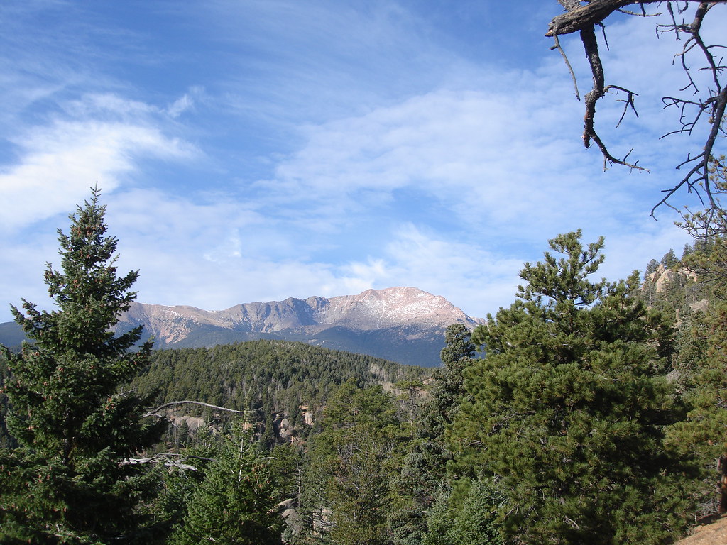
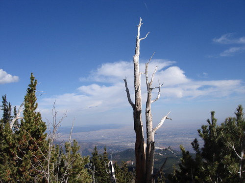
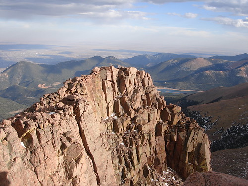
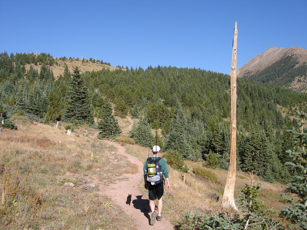
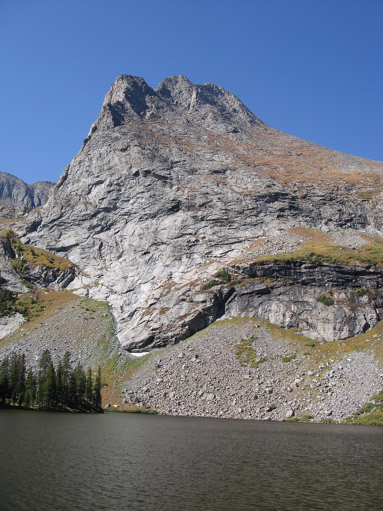
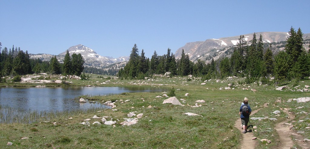
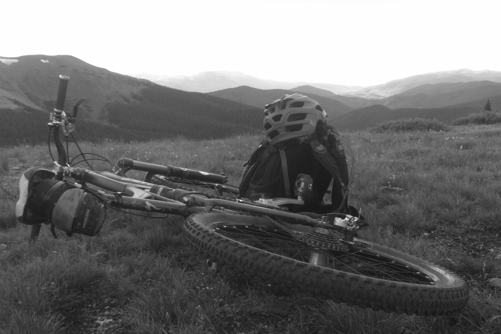
The top of Searle pass on Day 5 and my favorite picture from the Journey. To me this one says it all.

Wow what can I say about this adventure. Well it was one of the best experience of my life! I was in the best riding shape of my life. I had my best bike ever and rode what seem like endless incredibly buff single track trail for 5 days straight. It all started in ’05 when my dad bought me The Colorado Trail Official Guide Book and spent may days and nights studying the sections and dreaming that one day I could ride a multiday adventure on this amazing trail system. The Colorado trail spans 500 miles from Denver to Durango over the best parts of the Colorado Mountains. We chose to ride the first 9 sections of the trail from Denver to Leadville. These first 9 sections are considered some of the best for Mountain Biking.

The Colorado Trail had it all. Long descents grueling climbs, high alpine meadows and plenty of buff single track. There were several occasions where I caught myself gasping at the amazing beauty of the trail and the scenery surrounding it. I was in love!
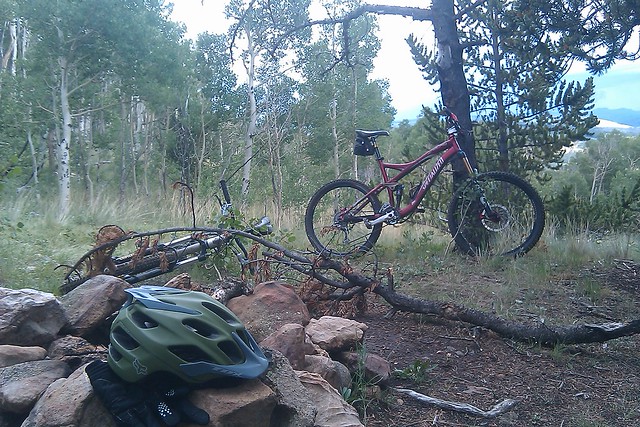
Mechanical
Believe it or not we rode 180 miles without a single mechanical. Not a flat tire, broken spoke or chain. Hats off to our Mechanic Chis Kuhn for setting our bikes up perfectly for the ride.


Food

Our food planning has gotten really good. Although we were running low on day 4 prior to getting to Breckenridge to resupply. My favorite would be the tuna wraps I have been bringing on my backpacking and bikepacking trips. It consists of a packet of albacore tuna, tortilla wrap, and mustard/mayo packet. Mmmm good stuff!

Camping
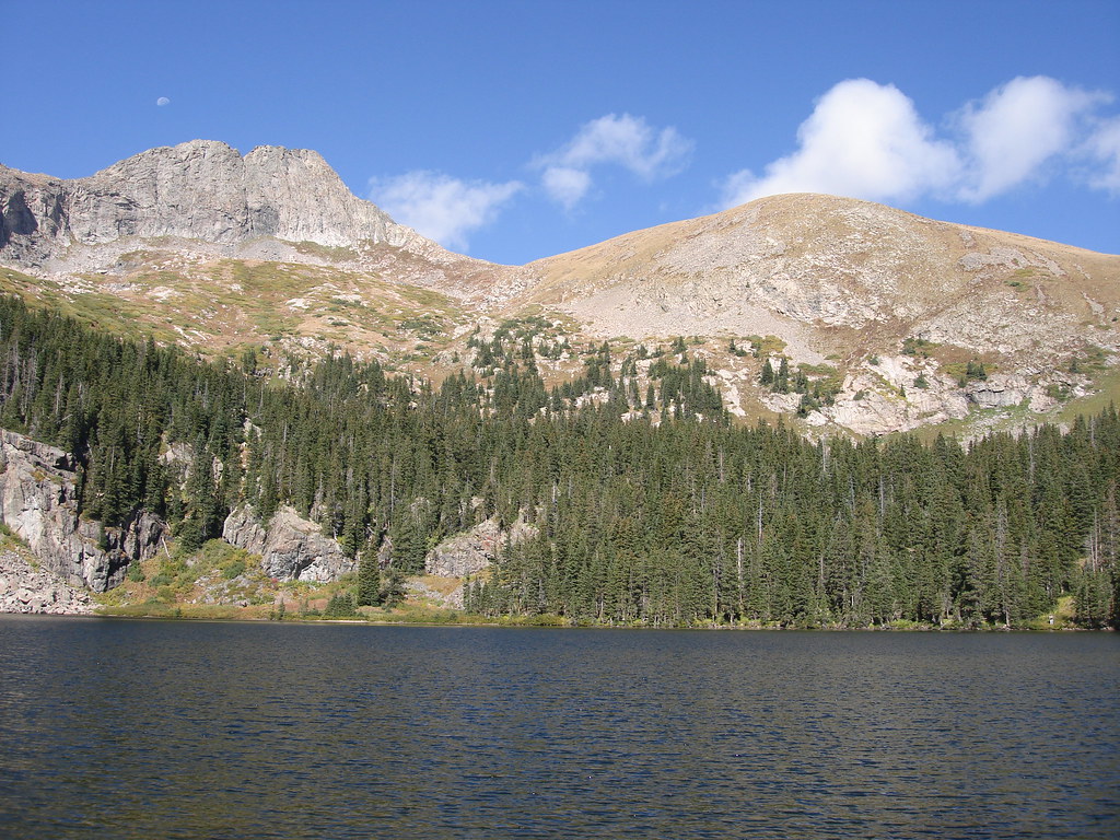
My favorite camping spot was in Lost Park. Such a beautiful valley tucked away next to the Kenosha Mountains.

Best Day
By far day 5. I felt like superman this day. Somehow everything was clicking and the riding was phenomenal this day. There was a 4 miles stretch of alpine riding from Searle Pass to Kokomo Pass that was to die for.

Worst Day

By far day 2 when we made the choice to disassemble our bikes and strap them to our backs to cross a 6 mile wilderness section. It took 5 hours to cross this and was one of the most painful experiences in my life!

Most Memorable Moment

Before Kenosha pass I remember zipping through this aspen grove that was lush with thick green ground cover all over. There was mist floating along the ground. It almost seemed almost supernatural.

The Gear

IMAG0096
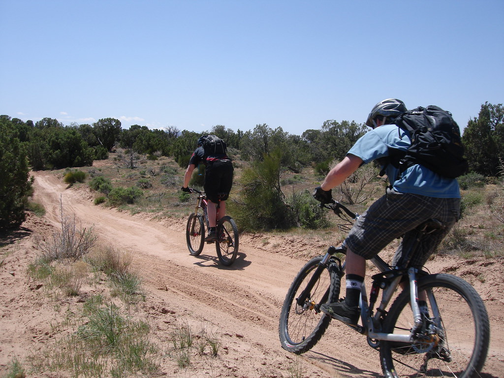
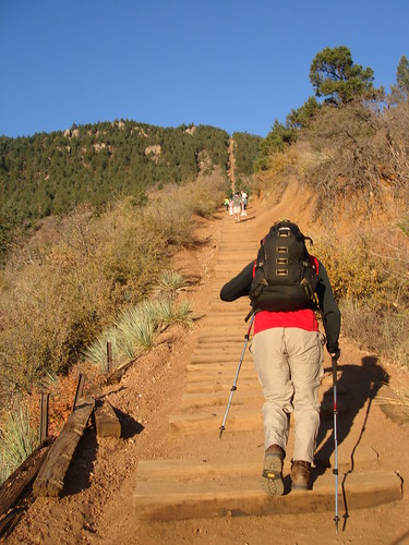
I really feel like I got my gear dialed in. Most bike packers these days are running bike bags to carry most of their gear. Personally I feel bike bags are going to take away from your bike handeling. By using backpacks and a small seat bag I could rip the descents like no other. Also since we had two people we could divy up the gear between the two of us. In the past we each had a stove, waterfilter, tools etc. Now we share and just bring one of what we need. This really lightens up the load.

Packing List:
REI quarter dome 2 man tent minimalist set up. This means just the rainfly and footprint.
Katadyn water filter
Jetboil Stove
Jacks Quilt with a Thermolite liner (awesome warm comfy combo)
Big Agnes Insulated aircore pad
Maps Tools and Headlamp

Day one Waterton Canyon to Buffalo Creek

IMAG0098
Here we are at the official CT Trail head. We left the day before the closed Waterton Canyon for a reclimation project. We were pumped!

IMAG0102
One of our few wildlife encounters on the trip. This scraggly looking goat needs to eat!

Photo0202
I have never ridden section 1 of the CT. We finished riding the 6 mile dirt road though the canyon and started the singletrack. Good stuff!

IMAG0105
The Colorado Trail was marked ok. I had brought my GPS and downloaded the official waypoints that corresponded with my map. Turned out to be very handy and made navigation a breeze.

Photo0204
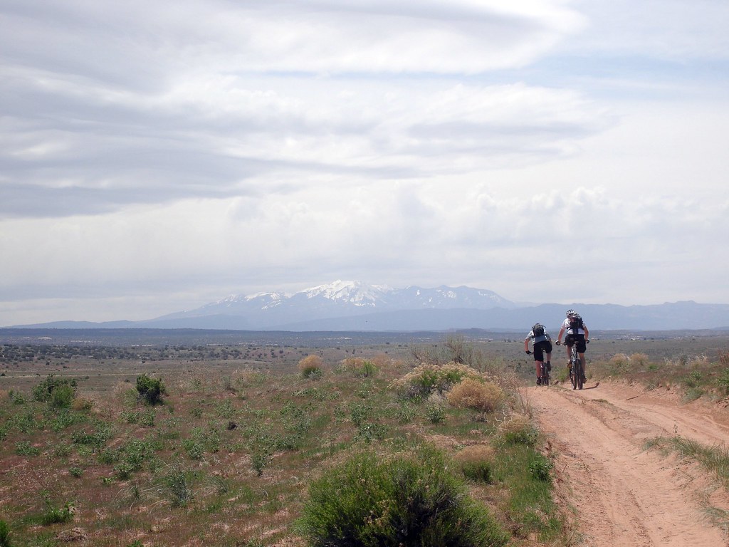
Here overlooking the South Platte Canyon. Off in the distance you can see the burn area which we hit at mid day. I knew we were in for a hot climb.

Photo0206
Indeed it was hot. And the heat was taking its toll on both of us.

IMAG0108
Still some really nice trail. The climb through the burn area was about 4 miles.

IMAG0109
Mike taking off his helmet to try and stay cool.

IMAG0110
After what seamed like forever we reached the top of the world area and we were making a good pace again.

IMAG0112
Here we are at the day one campsite in buffalo creek. It felt good to rest after battling the heat all day. Next time I will plan the ride differently so we don’t hit the burn area at the peak of the day.

Day two Buffalo Creek to Lost Park

Photo0210
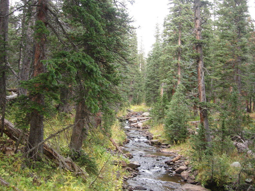
It rained non stop the first night. For the most part we stayed warm and dry. Our gear ended up a bit damp but no biggie. Here I am filtering water for our next segment.

IMAG0116

Photo0211
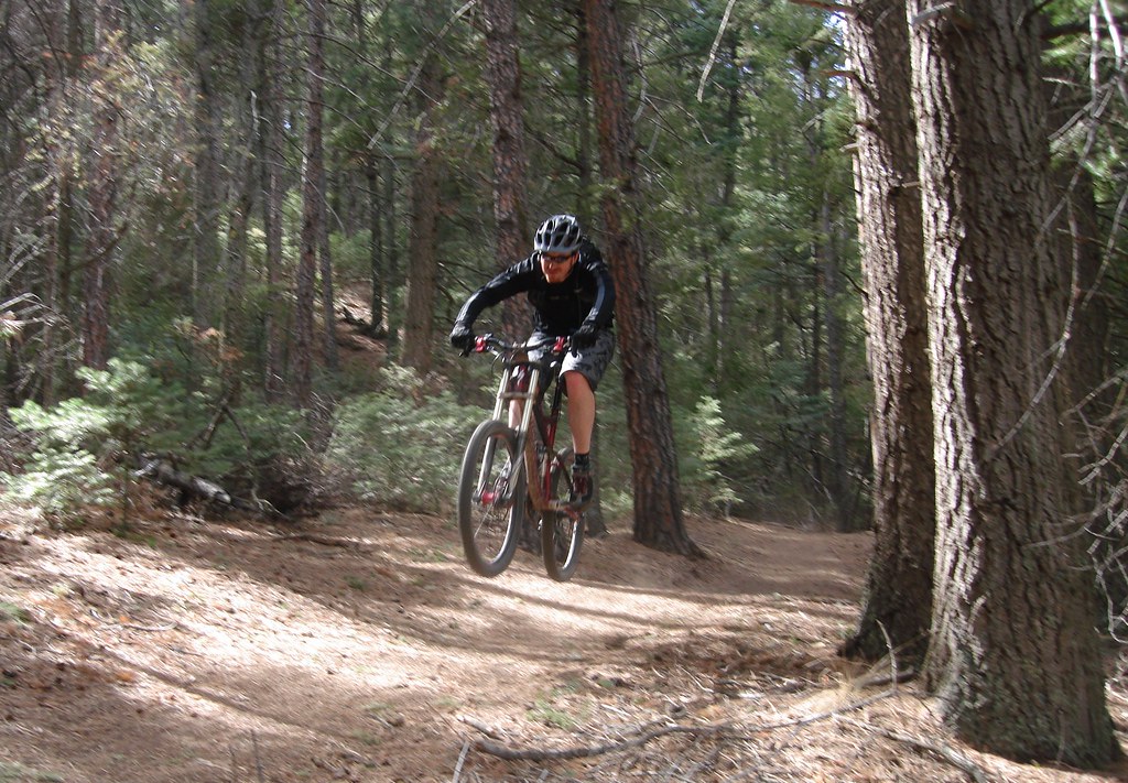
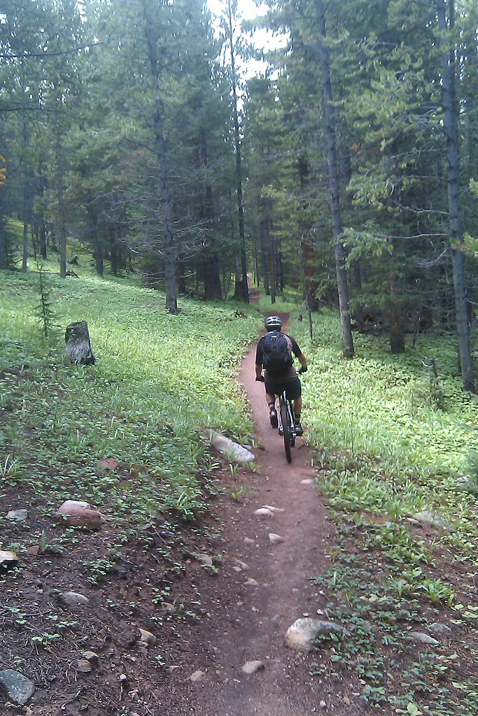
Buff single track that seemed to run forever.

Photo0212
Les Grills says “A positive mental attitude is key to survival”

IMAG0120
Being minimalist bikepackers we used our cell phones as cameras.

Photo0218
We stopped for a minute to let our gear air out and prepared for what turned out to be the most difficult part of the journey. We are at the Lost Creek Wilderness boundary and you cant ride a mechanized vehicle in the wilderness. So we took the wheels off our bikes, strapped the frames to our pack and hiked for 6 miles over some tough terrain. This turned out to be a bad idea and we should have taken one of the suggested detours from the guide. Our packs were not designed to carry the weight of the frame and the straps dug into our shoulders with excruciating pain.

Photo0220
This is how it went for 5 hours. Walk 100 feet. Stop and lean forward to shift the weight off your shoulders because they were screaming in pain. Rest for a minute then repeat.

IMAG0124
This picture shows how beat down we were. Talk about suffering. But looking back you forget about the pain and remember the adventure.

Day 4 colorado trail
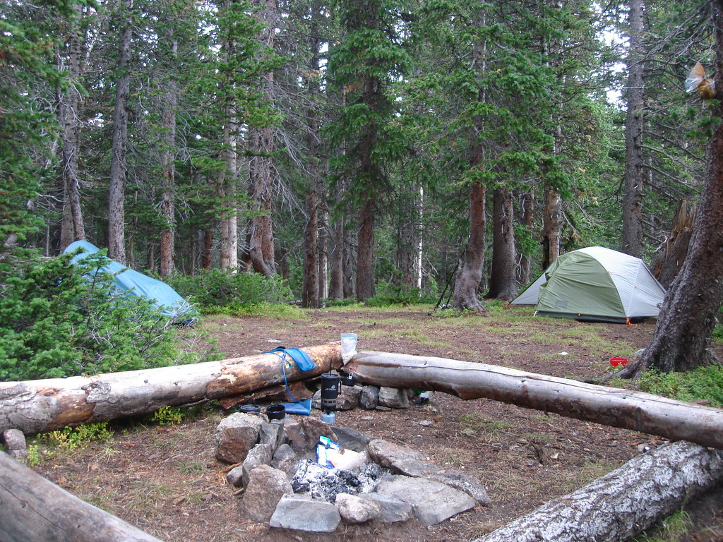
Tired and weary we set up camp in lost park. Here we are inside our tent. It was roomy and often we cooked inside because it rained every night.

Day 3 Lost Park to Middle Fork of the Swan River

Lost Park day 3
So we woke up to one of the most amazing views. Lost Park was beautiful. Day 3 was off to a great start. We aired out our gear, ate some breakfast and got ready for another day of adventure.

IMAG0140
Right off the bat we had a sweet descent.

Photo0228
We exited the trail briefly to detour a short wilderness section.

Photo0231
A quick check of the GPS and we are back on trail.

Photo0233
The Section of CT on the East side of Kenosha pass was really nice. We were running a bit behind schedule and was hoping to make it to Breckenridge this day. Judging by our pace we were not going to make it. We were worried about the amount of remaining food we had. Lucky we met a very cool thru hiker named Tony that was kind enough to part ways with one of his dinners. The extra food turned out to come in very handy. Tony if you ever read this Thanks!

IMAG0153
We hit another really good descent before crossing Kenosha Pass. Zipping through aspen groves is one of my favorite things you can experience on a bike.

IMAG0157
We crossed Kenosha Pass and came upon the “real South Park”

IMAG0159
Here we stopped for some lunch. Spagetti!

Photo0240
IMAG0162
We are climbing again. This time up to the 11,800ft Georgia Pass.

Day 3 Georgia Pass
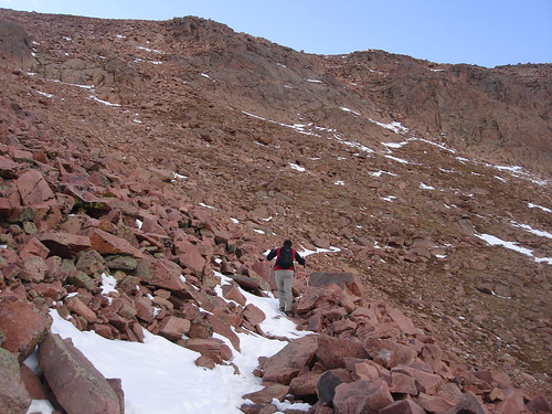
The air was getting thinner and we crossed treeline. A little hike a bike never hurt anybody.

IMAG0177
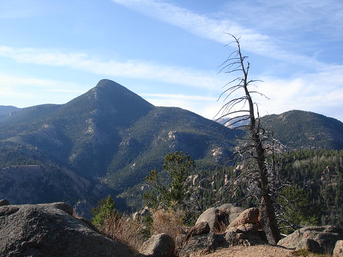
Ahhh! Nothing feels better than reaching the summit of a high alpine climb.

IMAG0181

Photo0246
We descended a few miles on the backside of Georgia pass. It was getting dark so we found a cool campsite and got some rest. Day 3 was great. Lots of great trail and I recall 3 amazing descents all in one day.

Day 4 Middle Fork of the Swan River to Breckenridge

Photo0249
Here is a shot of our Campsite. It only rained a couple of hours that night. Not bad compared to the nonstop rain we were used to. For the most part we were lucky and the rain would hit us as soon as we would crawl in the tent.

Photo0258
Getting some much needed water.

IMAG0195
So we had one good climb before getting to Breck that took us over 11,000ft. We ate the last of the food that Tony had given us the day before and were very anxious to get into town for a real meal.

IMAG0197
The descent down to Horseshoe gulch was one of the best. You could tell this section of the CT was ridden frequently and there were lots of fast buff sections of trail with nice banked corners. We both had huge grins on our faces during this section.

IMAG0201
Finally! Heading into Breckenridge for some much needed R&R. I couldn’t peddle my bike fast enough on the 4 mile bike path into town.

Photo0259
After eating a plate of nachos and a huge hamburger in Breckenridge we found a hostle to stay in for only $31 a night. An easy choice after A cold front had moved in and it was rainy and quite chilly. A warm dry bed sounded to good to pass up.

Photo0260
The folks at the fireside in were very nice and even washed our clothes and let us use wear some comfortable threads while we stayed. We grabbed a six pack of PBR’s and relaxed in the hot tub for for a few.

Photo0261
Picture of our room.

Day 5 Breckenridge to Leadville

IMAG0214
So we skipped Segment 7 of the CT and took the 10 mile bike path detour to Copper Mountain. It was nice. Here we are starting to ascend the first part of the Copper section.

IMAG0215
Here we stopped for some water before climbing some more.

IMAG0217
The climb up to Searle Pass was really chill.

IMAG0218
Dank Trail!

IMAG0223
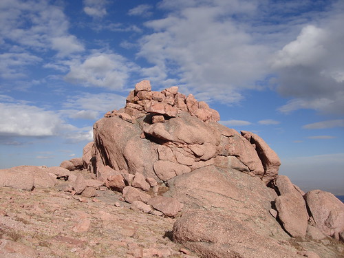
The Carins were huge!

IMAG0225
We crossed tree line and were feeling the anticipation of reaching Searle Pass.

IMAG0226
Alpine Time!

IMAG0235
IMAG0234
IMAG0233
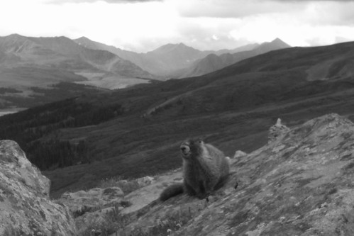
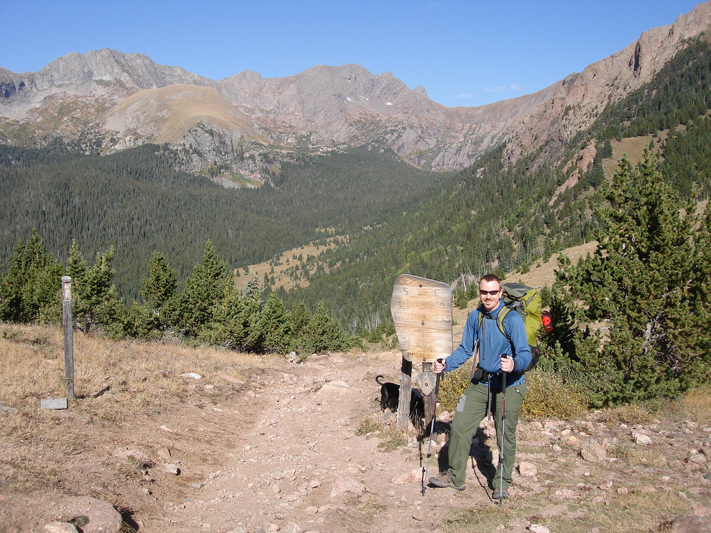
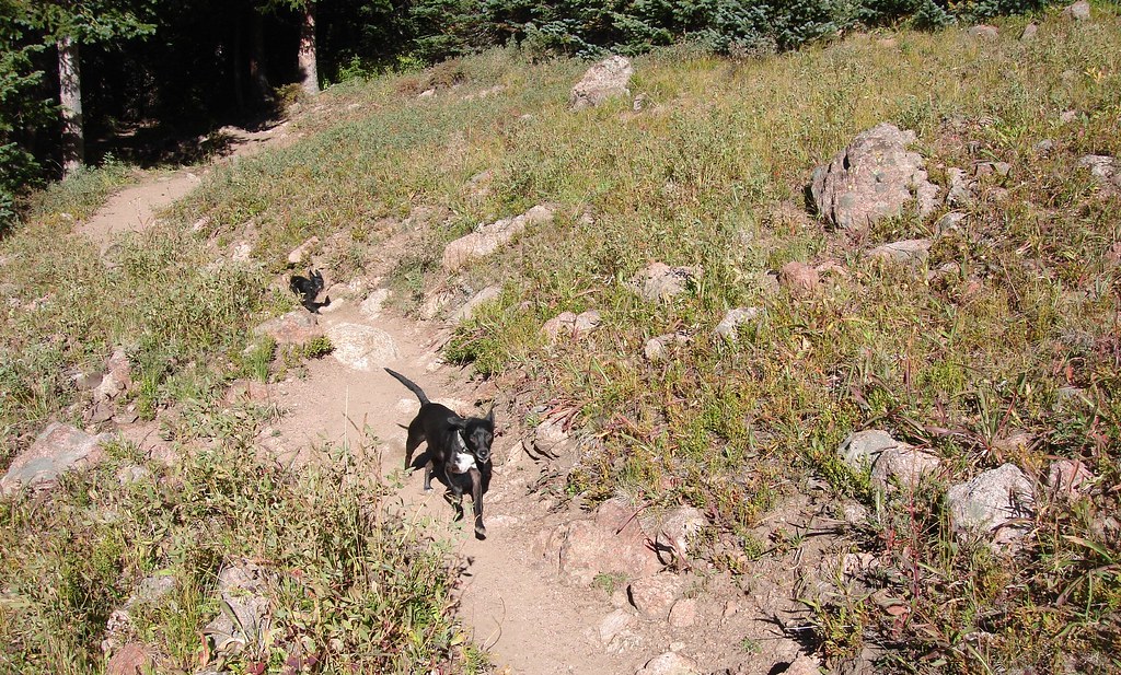
We had reached the top of 12,040ft Searle Pass and celebrated a bit. Also we made a furry friend! We knew from here the hard part was behind us and were going to make it to Leadville this day.

IMAG0240
IMAG0242
After Searle Pass we were treated with about 4 miles of smooth Alpine riding to Kokomo Pass. Mikes having such a good time his tounge is sticking out!

IMAG0251
After what seemed like a quick descent we stopped for a rest at a waterfall by Camp Hale.

IMAG0253
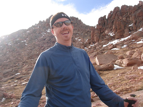
Mike contemplating his life on one of the CT bridges.

IMAG0254
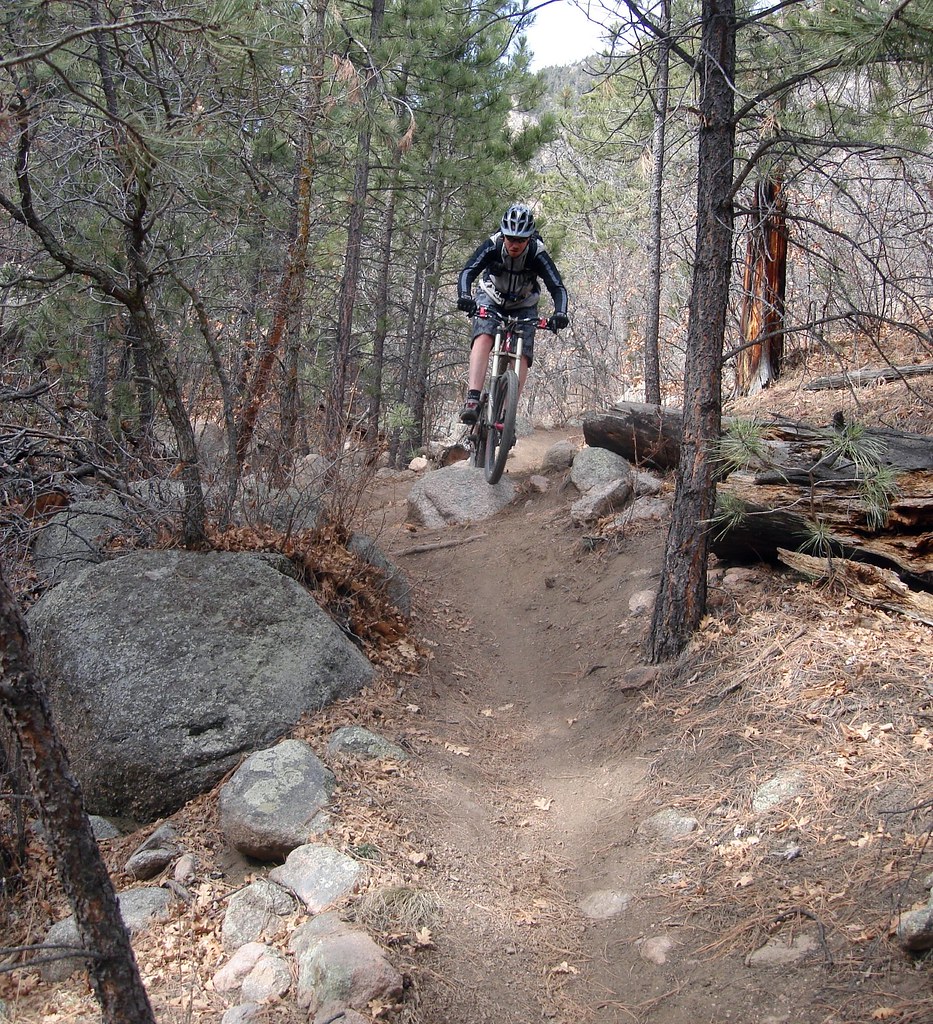
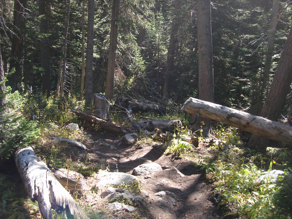
Some final Single track before reaching Tennessee pass.

IMAG0255
Hy 24 off in the distance

IMAG0256
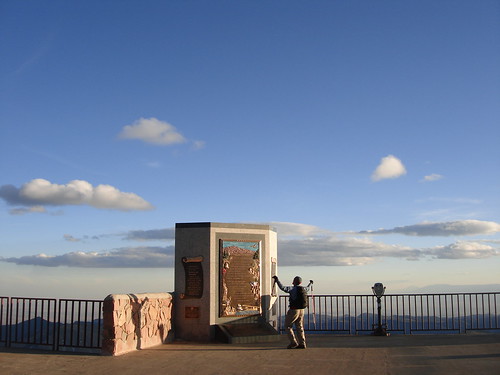
And here we are at our finish line. Completing one of the most amazing journeys of my life. After this we rode about 10 miles of highway into Leadville. We stopped at the Pizza Hut and waited for Mikes girlfriend to pick us up. 180 miles total!

Now Thats a KOKOPELLI!!

DSC05058
At our campsite on North Bever Mesa and my favorite shot from the ride.

Unable to shrug off the upset of not 100% completing the Kokopelli supported last April Mike and I gave another attemp this time self supported and in the last week of September. I really got my pack weight down this year. My pack weighed about 12 pounds dry. Last year it probably weighed 20 lbs. 8 lbs makes a Big difference over 150 miles.
DSC05036
Here we are at the start. We stayed in Moab the night before and got up at 0 dark thirty to take a shuttle back to the trail head in at Loma. There was a group of girls that were getting ready to ride the Kokopelli the same time we were at the trail head, they were from Taos NM. One of them took this shot. Thanks! We never saw them again.

This year my pack consisted of the following.
1 Down Summer Quilt
1 REI Minimialist Bivy
Big Agnes Air Pad
Katdyn Hiker Pro Water Filter
Silk Thermals
Hat
Tools
3 water bottles (one on bike)
Food

My Bike Preformed unbleivelbly well. My suspension was soft the first day but after I gave it several shots of air from my new uber light shock pump it made for a perfect ride. We had 0 flats no broken chains nothing nada….

DSC05038
Here we are in Rabbit Valley already. Seems like we are making good time but it is HOT!! Its has to be in the mid 90’s and water conservation was a must.

DSC05041
We had made a costly wrong turn in Rabbit Valley getting about an hour off course. We were already low on water and had the toughest part of the day ahead of us since we take the Western Rim option. Western rim is a blast but there is a tough hike a bike out at the end. I cramped on this one since I was out of water by the time we got to the hike a bike. The first day was the most difficult due to the wrong turn and heat.

DSC05046
Releived we arrive at our night one campsite at Westwater. Westwater is a drop in point for rafters on the Colorado River. Lots of rafters camp there and its always an intersting crowd. Plust there is a water spout there. This year we got offered free beers and and some of the best brownies I have ever had by the rafters.

DSC05048
I had my first rattlesnake encounter. There were tons of lizards and snakes on the Kokopelli. We camped night 2 at Cowskin Campground about 4 miles up Entrada blufs road. It made for a nice slog finish for day 2 but was well worth it. Cowskin was peaceful and very beautiful. We had stashed water food and some cans of Old Chub. It was one of our better improvements made vs. the self supported trip in ’08

DSC05051
Les Grills says we have reached the national forest boundry. I rode with my helmet in my pack most of the trip. It was just so hot and the bandana kept my head cool and the sweat out of my eyes.

DSC05055
This is the third day. Even though it was a full day of climbing it was probably the best day.

DSC05042
One of the zillion lizard friends I made on the trail.

DSC05056
At the top of Fisher Valley looking out at sundown. This was our night 3 campsite. We ended up getting rained on and I was not prepared for it and ended up getting wet in my bivy. Should have brought the rain jacket oh well.

DSC05035
So it was a great Kokopelli adventure. Self Supported is way more fun. The elements were the most challenge on this run. Scorching Temps, getting rained, Hailed, sleeted on made it that much more interesting. We made it!

Kokopelli 09′

This year was a new approach to the Kokopelli adventure that turned out to be an action packed highly relaxing fully supported multiday mountain biking adventure. Those of you that are not familiar with the Kokopelli Trial it is a 150 mile routh the the desert following much of the Colorado River through dusty, twisty, rocky, ledgey exposed single track and jeep road. This route packs some of the most rugged unforgiving yet spectacular terrian I have ridden. I love spending time in this part of the country. Our crew was fourtunate to find campsites with the most amazing vistas right along the Colorado River boxed in by steep canyon walls.

We started our adventure at the Loma Trail head. This year I was much more relaxed.
DSC04202
Jen is on the right our support driver. Steven Mike and Myself on MTB’s. Oh and of course our Kokopelli Mascot dog Roxi.

DSC04207
And we are off here is Mike leading the way on Marys.

DSC04211
Steven just getting done ripping a techy spot on Horsethief Bench.

DSC04224Wow look at the Colorado Down there!

Notice my pack is much smaller this year. They joy of having a support vehicle is you can carry much less stuff and really rip the trail.

DSC04225
Handcuff Loops is a fun section that included one of a billion cliffs we rode along.

DSC04242
You can see the Handcuff loops down there. If you ever have a chance to ride this section I would recommend it.

DSC04245
We stop for some traffic. You can see the riders off in the distance.

DSC04261
No complaints so far.

DSC04255
Dont ask me what this guy was thinking!>!??

DSC04272
Here is that crazy hike a bike out of the canyon that Salt creek runs through.

DSCF3759
Here we all arrive at our totally kick ass day one camp spot. I cant believe how lucky we were to get this cool location. It was in Knowles Canyon Overlook Campground and had amazing views of the canyon below and the Colorado River.

DSCF3761
Not a bad way to wake up on day two.

DSC04294
And we are off for Day Two. This was one of the best sections because we were able to hit the Western Rim trail for the first time with perfect weather. Last year we missed it due to no trail markers and strong wind.

DSC04300

I cant begin to tell you how fun the Western Rim trail was to ride. Easily one of the best singletrack options in the region.

DSC04303
This trail scared the bejezeze out of me. We got off trail and it squezed us right up aginst the exposed ledge!

DSC04308
More of the Western Rim

DSC04312
Yes the trail skirts along this cliff

DSC04315

DSC04318

http://vimeo.com/moogaloop.swf?clip_id=

Wesern Rim from Jason Moyes on Vimeo.

DSC04319
This section of the western was highly fun. Whoop de doos everywhere and lots more small drops.

DSC04320
Steven, Mike, and myself stop to have lunch. It was hot and sunny this was the only patch of good shade for miles. Steven and I packed tuna sandwitches. What a bunch of dorks.

DSC04324
Here I am cleaning a nice tech climb section. We decided to finish off the day on the Overlook trail that turned out to be a bitch. It was had to follow and had lots of soft sandy sections combined with rocky ledges and tech sections. It ended up finishing us all off for the day. Good thing camp is only a few miles away.

DSCF3779
Day 2 camp site at West Water. Not quite a senic and remote as Knowles but still fun. There was another group of riders taking a guided tour through one of the small tour companies and they had along with them a talented singer/guitarist that played some great songs till bed time then woke us up again the next morning at 7:00am sharp. I slept about 10 yards from the shore of the colorado river.I feel like a I am starting to bond with this river a bit.

DSCF3782
Ahh the joys of a supported trip. Fettachini Alfreado! Self Supported I would be eating a frezed drid bag of somthing. All of our meals turned out excellent and our breakfast mostly consisted of breakfast burrito stuff.

DSCF3793
So here we are ready to tackle another section of the Kokopelli. Today we had Westwater to Cowskin Campground This was a tough day battling strong head winds and hot sun. It was a constant push for about 30+miles.

DSC04343
We managed to have a blast despite the windy conditions.

DSC04347
Wide open spaces. For some reason this is the most erie section of the Kokopelli to me.

DSC04349
Good ole county road. I drafted mike as much as possible this day.

DSC04357
Here is an old foundation that we came across and took a break in the cellar.

DSC04355
Here we are taking a break from the wind gusts. It was creepy down in this old cellar.

DSC04382
It was nice to have other people carrying the camera on this trip. I got lots of good shots with me in them.

DSC04390
Mike and I pressed on the complete the Yellow Jacket Canyon section. This turned out to be one of the trip highlights.

DSC04406
DSC04405
DSC04407
It was late in the day and I shoud have been beat from riding head on into wind all day but some how I was energized and had a great climb and amazing decent down YJC. Lots of slick rock and really cool sandy section that you can surf over.

DSC04412
I was getting low on water.

DSCF3829
Here is our cool campsite for Night 3. This was by far my best nights sleep. I had the rain fly off and fell asleap to the stars. We were not at cowskin but at a campsite by the Delores River.

DSCF3836
So we ended up skipping a day on of the luxuires of a supported trip. We were all tired after 3 days straight of riding and the day prior was full of harsh wind. Also we got bad reports that the Polar Mesa section may be closed and still coverd with snow. So we skipped a major part from basically Dewy Bridge all the way to the Beginning of UPS, LPS, Porcupine rim trail.

DSC04440
Rested rechared and full of excitement we got dropped off by Jen at the start of the commonly shuttled Porcupine Rim. Lying before us are some of the best sections of the Kokopelli route, the Kokopelli connector, UPS, LPS, and the classic Porcupine rim trail.

DSC04445
This is the only picture I got on the super fast decent on the Kokopelli Connector Trail. The Kokopelli Connector trail is the trail between Hazard County and UPS. Last year this was muddy but quite the oppisite this year, hard packed, smooth, and scary fast!

DSC04446
Oh lookie here the UPS is official it has its own sign. This section of singletrack is to die for. Whom ever laid out this trail did an amazing job of utilizing the terrain for maximum fun.

DSC04449
Time to reflect…….

DSC04452
Steven skirting along the Procupine Rim.

DSC04469
Ummm group photo I guess.

DSC04473
And its time to wrap up the Kokopelli. When we got to the bottom we met Jen and got a ride back into town.

Cheyenne Mountain State Park 3.1.2009

It was a warm and mild March 1st day. Spring as come early this year and it has been great to get some early season riding in. Today we had a group of 4, me Mike, Steven and Haven. All of us had fun and Haven and Steven had a good wipe out or two. That just means we were pushing it.

At the top of the Talon Loops there is a really cool roller coster section that rips fast through a heavily wooded section of the trail and offers and string of fun jumps. At the end of the post are a couple of cool videos of Haven and Steven Ripping the section.

DSC03ss957
This section is a must to hike up and hit the the jumps once more

DSC03950
Steven floating off of one of the many bumps

DSC03956
Haven catching some nice air.

DSC03939
Here Comes The Crew

DSC03944
Me comming down the end of Cougars Shadows

DSC03934
Mike being Mike

http://www.flickr.com/apps/video/stewart.swf?v=67090
Video of Steven riding smooth

http://www.flickr.com/apps/video/stewart.swf?v=67090
Haven hitting the same section

Backpacking Pikes Peak in November!


Ahhhhh Beautiful Pikes Peak off in the Distance. As a native to the Springs I have always been fascinated with this Mountain. Barely touching any of Barr Trail throughout my whole riding career and exploring singletrack surrounding Pikes Peak, I have always dreamed of a chance to ride my mountain bike up and down Barr Trail summiting Pikes Peak. After many years of this dream I finally managed to hike the peak only because I broke my hand this summer and got more into backpacking. Being very late in the riding season and Mike having issues with his suspension fork on the front of his mountain bike he suggesting hiking the peak. The weather forecast called for 74 deg on Saturday and about 74 deg again on Sunday and since I had so much fun backpacking the peak solo in September, hiking the peak on a beautiful weekend in November sounded like a dam good idea.


So we thought starting off on the Incline would be a fun way to start the trip. Maybe fun is not the best word to describe hiking the incline with with a pack on. Our quads paid for this later!!


Whats the name of this Peak? Its killing me I will have to look on my map.
UPDATE: Its either Palsgrove or Marys Mountain.


Good ole Bar Camp These people are very friendly and we we grabbed a soda and candy bar. Barr Camp is halfway up Barr trail and an excellent resting place.


Dis be me. I dig using trekking poles while hiking. Somthing about it makes it more technical and fun.


We are starting to get up in elevation. I would say we are close to 11k feet and not to far from the A Frame when this picture was taken. Spectacular views are non stop on this route.


One of my favorite shots from the trip. We just got done setting up camp at the a-frame and pushed on to finish the summit. Getting from the a-frame to the summit then back down to the a frame proved to test our limits.


One of my favorite things about this trip is the massive time you get to spend above treeline. It is a diffrent world so close to home.


Honestly I have no idea why I am laughing in this picture but I am sure it has somthing to do with the high alititude euphoria.


A cool Rock Pile above Treeline


Blair Rock or somthing like that.


We are getting closer to the top. The snow is not to bad. Trekking poles help keep you steady on the icy spots.


America the Beautiful!

So we summited right at dusk and had a good 2-3 hour hike back down to the A Frame on what turned oout to be a dark and icy decent. After a windy nights sleep we made a fast pace back down to the trail head. We stopped by Amandas Fonda on the way back home and I cant tell you how unbelieveibly good a smotherd burrito and margarita are after hiking 26 miles with about a total of 16,000 ft of vertical.

Lower Sand Creek Lake

Lower Sand Creek Lake is one of the most beautiful places I have ever explored in Colorado. The Photo below is of Tijeras Peak Located in the heart of the Sangre De Cristo Wilderness. I definitely want to go back soon.
Lower Sand Creek Lake 9.21.2008 I woke up right at the break of dawn and saw the peak glowing unlike anything I have ever seen.

Ryan is signing us in at the Music Pass Trail head. There is a short 4WD road to get here

The hike up to the top of Music Pass is pretty easy. I could start to feel the altitude and the weather was perfect!

Here I am at the saddle of Music Pass and the wilderness boundry. The panoramic views here were amazing.

I brought my two small dogs on this trip and they did great. Lucy (aka double back Lucy) did double the miles because she would trot ahead of us then run back, trot ahead run back over and over.

Here is a shot of trail on the switch backs aproaching the lake. The forest gets damp and dark through here.


This is one of the first views you get as you come out of the woods to the lake shore. Spectacular! I ended up picking a fishing spot back along the scree field below the peak which turned out to be a great idea. I was catching the most beautiful trout left and right and was planning on having a delicious trout dinner. Unfortunately the three beautiful trout I had on my line escaped. Oh well maybe next time.


A view of the lake looking at the north shore. My camera certainly did not have a wide enough lens to capture everthing the area had to offer.

So the weather went from sunny and clear to cold and rainy in what seemed like 5 minutes. Despite things getting soggy I loved this camp site. I like the well constructed fire pit and seating.

A picture of Sand Creek on our way out.Overall about 6 miles of hiking and not too much vertical. I would highly recommend this trip. It would be good to stay an extra day or two stay a night at Upper Sand Creek Lake. Cant wait to make another trip.

Backpacking Pikes Peak Solo

My first trip up and down Pikes Peak. I am goinng to try and add Data to my trip reports from now on.

One thing I will never forget is camping at 13,000 feet and having a Pika attack my bivy all night. He did not like me camping up in his patch of rocks.I also made a wrong turn about 2 miles up the trail and ended up climbing the top half of the Incline in the dark. Also there was the Pikes Peak Challenge going on. You cant tell from the pictures but there was easily about a 1000 hikers climbing the peak that day.

backpacking pikes peak solo
America The Beautiful
The lyrics to this America the Beautiful were written by Katharine Lee Bates (1859-1929) an instructor at Wellesley College, Massachusetts, after an inspiring trip to the top of Pikes Peak, Colorado, in 1893.

backpacking pikes peak solo
Here I am after making the Summit. Even though I have been to the to via car in the past this one had much more meaning.

backpacking pikes peak solo
The Cirque, its scary to look over this edge.

backpacking pikes peak solo
Here is my camp site at 13,000 feet just 1 mile from the summit. I was attacked by a pika all night and it was extremely windy all night hence a night of camping that I will never forget.

pikes peak gps
Here is the GPS data layerd over google earth. Pretty Cool! Round trip was 26 miles and tons of vertical. I was beat and did the whole trip solo with a cast.

Yellowstone/Beartooth 2008

Another awesome trip to the Beartooths this year with new adventures and a trip to YNP. For some reason the Island Lake > Beartooth Lake trail has it out for me. Seth brought along his friend Haven and my Dad got up there without his Bronco breaking down.. ha ha The weather was perfect but our backpacking trip to Beauty lake did not work out as well as planned thanks to the constant mosquito attacks!!! The river behind the cabin offered non stop cast and catch fishing for a couple of days. The river was high and there was a good bit of snow up on the Beartooth Plateau that made for muddy hiking and biking. Unfortunately I wiped out on one of my bike rides with Haven and broke my hand leading to 5 screws and a plate to put it back together again. No worries we still had a great time and had lots of fun. I will never forget the 2 day long risk battle that ended in a stalemate between Seth and I (:

As always great food, amazing adventure, unreal fishing, and great company made this another grand Yellowstone vacation.

http://www.flickr.com/apps/slideshow/show.swf?v=63961
This is a long slide show but worth it. You can make the slideshow full screen by clicking on the button in the lower right corner of the frame. I managed to get some good shots off this year. Seth and Haven did there part to capture some good photos also.

Ring The Peak Trail an Out and Back


After a couple of years of seeing the Ring the Peak signs on Bear Creek Trail and over off of the Intemann Trail I thought it would be cool to investigate further into the route. I thought that the concept was awesome but was a bit put off by the fact that there was a good bit of riding Highway 67 and most of Gold Camp Rd. So after a checking out the route further, a 2 day out and back would be an excellent idea making sure we link the best sections of single track with out having to touch our tires to a road.

The plan was start in Chipita Park at the Mt Ester Trail Head, ride around to the Catamount reservoir and head to the Crags. From the Crags travel through HorseTheif Park finishing at Pancake Rocks to camp for a night then retrace our route back to Chipita Park the next day. It turned out to be an excellent bikepacking trip and one I foresee doing at least once a year. It is a great way to get up close and personal with the North and West Side of Pikes Peak. Plus it’s about a 20 minute drive to the trail head for me to start this awesome local adventure.

Ring the Peak
Here is the Trail Head for Mount Ester. This is a grueling hike a bike with about 1.5 miles of pushing your bike over steep rocky switch backs. Turned out to be a little more than a warm up with our packs on.

Ring the Peak
Ryan Pushing his bike up a steep set of stairs. I will say that coming down these switch backs is a whole different story.

Ring the Peak
Starting to get up in elevation. It is at least a good 1000 feet of vertical up this section. You can see Ute Pass Below and as you hike up you constantly hear Harleys sputtering up the pass.

Ring the Peak
Here is the start of the rideable single-track. From here things get really fun. Not too many Springs Mountain Bikers have ridden this tasty section of trail.

Ring the Peak
There is a really cool meadow up on this ridge above Chipita Park/Green Mountain Falls. It was hot and the skies were crystal blue.

Ring the Peak
Here is one of the few sections of fire road. The Ring the Peak route is very well marked you can see the marker off to the right..

Ring the Peak
After a bit of fire road you intersect a sweet little connector trail that takes you towards Crystal Reservoir and the Catamounts. I loved this section!

Ring the Peak
You could tell this trail is rarely used, baby aspens were sprouting all over the trail.

Ring the Peak
So there is a good bit of dirt road riding nearby Crystal Reservoir until you get to South Catamount. This is looking back at where we came from. There was a step section of dirt road to get here.

Ring the Peak
Once you get to North Catamount Reservoir you get to ride one of my favorite sections of single-track on the RTP route.

Ring the Peak
This is a interesting section of trail. It must have been used for a gravel pit. There was a marked trail but not much vegetation sprouting around here.

Ring the Peak
An inlet for the North Catamount Reservoir.

Ring the Peak
After you finish the flowy and very fun section along the shore of the North Catamount you can skip some dirt road by riding some double track called Mule Deer Trail. This trail connects you to the Limber Pine Trail, the same trail I had raced on back in the late 90s when the Local Sand Creek series was going on.

Ring the Peak
Here is the start of the Limbering Pine Trail. Recently the forest service must have cleared much of dead fall as there were wood chips everywhere.

Ring the Peak
This is the start of the down hill section of Limbering Pine. It was a blast to descend! Short but a blast.

Ring the Peak
So after of finish Limber Pine trail you head off to this really cool valley that starts off as a dirt road that transforms to double track then eventually single-track.

Ring the Peak
Cruising further down the valley which happens to be full of beaver dams and marsh. You can see the Crags off in the distance.

Ring the Peak
Close-up of the Crags

DSC02424
Colorful Colorado! Here is our state flower with bugs on it

DSC02426
So after a few hours of riding and the heat starting to get to us we came across this stream to take a break and filter water. Since I have started carrying a filter on my long rides I no longer run out of water and get cramps.

DSC02428
And we are off, this cool section of trail lead us to the Crags Campground area.

DSC02429
So at this point we have passed the Crags Campground and connected with a section of single track that proved to be tough but extremely fun. Lots of elevation to tackle and plenty of twisty technical single-track. We are now on the West side of the peak and the forest is much different that what I am used to on the Front Range side. The west side is more fertile and dense without the large amounts of decomposed red granite that dominates the Front Range.

Ring the Peak
After about 20 miles of what felt like 40 we came across this valley in hopes of finding a cool camping spot. 20 miles may not seem far but when you are carrying a pack full of camping gear and food it gets tough.

Ring the Peak
After a short excursion up the valley we came across this picture perfect meadow with a really cool fire ring already built. Nobody is around for miles!

Ring the Peak
Mikes 4 season tent. I got a new sleeping pad for this trip trading in my painful Thermarest for an inflatable Big Agnes pad that proved for a much more comfortable nights sleep.

Ring the Peak
I slept like a rock and whipped up some coffee and oatmeal for breakfast. The plan was to ride down the valley further and explore Pancake Rocks then make our way back to where we started.

Ring the Peak
To get to the top of Pancake Rocks there was a good hour of hike a bike. This is pretty much were the single track ends.Hopefully someday FOTP connect this section with Gold Camp Road. This way you do not have to go down and ride the Highway.

Ring the Peak
The trail up by Pancake Rocks was fun especially coming back down. We ended up getting bad directions to where the actual pancake rocks were. We never saw them. Not a big deal.

Ring the Peak
So we turned around at the top and headed back the way we came. There were about 24 tough miles ahead of us. Our packs felt heavy this day.

Ring the Peak
Sentenial Peak

Ring the Peak
One of the many Beaver Dams along the route.

Ring the Peak?
Shot of the single-track going up Horsetheif Valley. This is a very beautiful area that can be easily accessed at the Horsetheif Falls Trail Head off Highway 67.

Ring the Peak
What make the Ring the Peak Route so fun is riding all the well built connector trails that link the route. Here is a nice section filled with aspens.

Ring the Peak
I think if we would have found the Pancake Rocks they would have looked something like this.

Ring the Peak
I love riding along the Shore of the South Catamount Reservoir. I would describe this section as entry level Rampart Resivoir-ish riding.

Ring the Peak
Riding along the dam of the North Catamount Reservoir about 2/3 the way back.

Ring the Peak
Here we are crossing over the outlet of Crystal Reservoir. For some reason the trip back goes by quick.

Ring the Peak
A dank little section of trail getting us closet to the Mt Ester trail.

Ring the Peak
Taking a break before the final push back to the car and finish up this grueling but fun 2 day bikepacking trip.
So from here it is mostly down hill all the way back to the car and not to many more photos were taken. All in all we ended up riding about 45 miles over two day with large amounts of elevation. I was beat and it took me a week to recover even being in good shape. I look forward to doing this one in 2009.

The Kokopelli Experience

The Kokopelli Experience

There is many was to experience the Kokopelli, everything from comfy outfitters setting up support camps full of food and complete with massage therapists. To uber endurance athletes completing the trail in 12hrs straight. The Kokopelli Trail is really not a trail but more a well marked route on singe track, jeep roads, county roads and a bit of paved. The majority of the ride is rough jeep road that is fun to ride, but there is a good amount of wicked single-track and when the paved sections come up it’s a nice relief. I would say pavement was only about 10% of the route..

Leveraging my bikepacking experience from last year, me and my riding buddy Mike decided to do the Kokopelli self supported over 4 days. More accurately we did the ride in 4 ½ days to get an early start on the Fruita side of the trail. We invested a lot of time planning and picked the last week of April hoping to get a good balance of weather. I purchased the Lat 40 maps and the Bikerpelli guide book, made a meal plan, booked a shuttle from Moab back to Loma via Coyote Shuttle, (BTW they were super friendly and did great job) and did as much research as I could on water holes to filter water from and the route. Water was my biggest concern seeing how the ride was in the desert. As we found out it is possible to get water along the route but be prepared to have enough water to cover 30 – 40 miles between water spots. Also the Colorado River turned out not to be a good option to get water from. With the water being so silty it clogged our filters in minutes and completely shut down my Katadyn filter for the rest of the trip. The water got so hard to pump my handle broke off. Good thing we had both brought a filter as Mikes water filter had a clay cartridge that you could at least clean the silt off but was still very time consuming. The spots we ended up getting water from were Salt Creek. The spicket at Westwater ranger station. The Colorado River at Dewy bridge (took 3 hours to fill 2 camel backs). Hideout campground and a stream up on Beaver mesa. For food we purchased dehydrated dinners from REI and found them to be quite tasty and super easy to prepare on the trail using our Jetboil stoves. We also placed a cache to resupply food under the highway 128 bridge right next to the old burnt down Dewy Bridge.

Mechanical

I was the only one that broke down with 2 flats and 2 broken chains and pedal that the spindle was coming loose. Mikes bike had zero problems. Also my water filter broke lucky we brought two.

Food

My favorite trail food was beef jerky and powdered Gatorade. The best freeze dried entrée would be Mountain House Chicken Breasts and Mash potatoes.

Camping

My favorite spot was a backcountry spot past the LaSalle National Forest Boundary. Westwater was would be the runner up just because of the water spicket.

Best Day

The best day by far would be day 3 Westwater to Dewy Bridge. The weather was perfect and the trail was flat and fast. Yellow Jacket canyon was a lot of fun. Runner up would be the last day. Riding the Kokopelli connector UPS LPS and the Main Proc trail was as fun as ever. Even with our packs we were ripping it.

Worst Day

Day 4 Dewy bridge up into the La Sals. We got a 3 hour late start due to water filter problems and the entire day was up hill except for the short and rough downhill before Rose Garden Hill. I was starting to get monkey butt and my energy level was a bit low. Also we really had to conserve water this day.

Most memorable moment.

When we ran into a couple of motos on UPS. They asked us where we started from. I told them we started in Fruita and you could see the wheels turning in their head. They asked us when we started and I scratched my head and thought for a moment and said we started last Sunday. It was Thursday at this point. The moto guys thought we were crazy. Runner up. When I got up early to pump water out of the Colorado River at Dewy Bridge Campground, I was standing by the river and two calves came up to me and stared me down for a good 10 minutes and they gave me the WTF is this idiot doing look. Only if I had my camera.

Day One Loma to Salt Creek

The official Trail Head. We were super excited at this point and just got done driving from Colorado Springs and Taking a Shuttle from Moab back to Loma

Right away we start of with amazing views

And a flat. It was so windy I was swerving off the trail and must have hit a couple of goat heads.

Twisty singletrak with plenty of exposure to keep you on your toes

The Lions Section was tasty

Cool sign by the Salt Creek Bridge

Pictures of night 1 campsite right along side Salt Creek

Day Two Salt Creek to Westwater

A nasty hike a bike out of the Salt Creek canyon and the start of day 2

Desert Beauty

Here is the start of the county road that takes us into Rabbit Valley

Cruising into the Rabbit Valley area

Cool Rock that stood out in Rabbit Valley

Here is a good view from the top of Bitter Creek. You can see the Western Rim Trail below that we planned to ride but missed due to the poorly marked trails in Rabbit Valley. Also it was super windy this day and could only go a max of 10mph even down hill with the killer head wind we encountered. You can’t tell from the pics

On our way to Westwater we came upon a herd of sheep

Up and over, there were tons of rolling hills on the first half of the ride

Our night two campsite at Westwater

Mike enjoying his beans and rice for dinner after a tough and windy day two

Here is me getting ready to enjoy a cup of coffee at the morning of day three. Did I say I love my Jetboil stove?

Incase anybody is looking for their neoprene mask we found it in the bathroom at Westwater

Day Three Westwater to Dewy Bridge

Cruising by a bit of farmland as we leave Westwater

We hit a little slickrock patch one of many slickrock playgrounds along the Kokopelli

Day three was a piece of cake. Perfect weather no wind and mostly flat terrain this day went by fast.

Some cool looking rocks by Cisco Landing

One of the nicest things about the Kokopelli is how well marked it is. The frequent signs let you continue riding in your groove instead of stopping to check your map/guide at each intersection

Sweet! A nice long fast downhill on our way to McGraw Bottom

Another flat tire. This pic shows how big my pack was. Believe it or not the pack does not get in the way of your riding very much. Mike and I use the CamelBack Alpine Explorer

These are all pics of McGraw Bottom. To say the least this section of singletrack was sick!

This shot is on our way up to Yellow Jacket Canyon. It turned out to be a fun climb. You can see the La Sals off in the distance.

A little more slickrock up near the top of the climb to YJC

Yellow Jacket Canyon is easily bypassed by taking a 4 mile detour down Hy 128. There is some controversy if YJC is a good option because of how sandy this part of the Kokopelli. I say Do It! If you go South to North the major sandy sections are down hill and you can just sail through them. Also there is some wicked techy sections, one of them I went OTB with my pack on. Luckily I landed in soft sand.

One of my favorite shots from the trip near the end of YJC

Fear and Loathing Rocks

A gate crossing at the end of YJC. This picture is ironic, as the exact same picture is in the Bikerpelli guide book that Mike is checking out. You can see the burnt down Dewy Bridge in the background and Hy 128 Crossing the Colorado

Oh so sad. I was actually looking forward to crossing the Historic Bridge

What’s this? Cans of Old Chub and a stash of Food. Our one and only cache point was under the Hy 128 bridge

Night 3 Campsite at Dewy Bridge Campground

Day 4 Dewy Bridge to somewhere in the La Sal National forest

The next morning we went through all our of stuff and repacked for the remainder of the Kokopelli. This was the day we had water filter problems and I took 3 hours to fill 2 camel backs from the Colorado River. We got a late start this day

The long climb begins up Entrada Bluffs Road

Nipple Rock or that’s at least what I called It.

The climb gets steeper and rougher

CRYPTOBIOTIC!

Starting to gain some elevation

That’s Onion Creek down there. We just hit some gnarly down hill right before this point.

We ran into about 30 ATVs trying to get up the infamous Rose Garden Hill. This was the only guy we saw make it.

We are down in Fisher Valley at this point and just about out of water. The plan was to refill our water in Fisher Creek. Problem was Fisher Creek was completely dried up. We started to get nervous and was unsure where we would find water next. It was hot, windy and dry and we were starting to get a bit fatigued

We ended up finding water at Hideout Campground. Relieved we pressed on

The scenery is starting to change and we are climbing again into the La Sal National Forest

YES! The National Forest Boundary. It is late and at this point almost 7:30 pm. We are beat.

We finally arrive at our backcountry camping spot for our final night on the Kokopelli. Does Mike look a bit worn out?

It felt good to get some food in our system and rest. There was no water source near by so with careful rationing from the water we got at Hideout Campground we made it work.

Day 5 Final Day La Sal National Forest to Moab

So we pack up from our final night of camping eat breakfast, lube the chains, and got an early start on the final day. We still have a long way to go to make it to Moab

I still managed to take a minute to capture shots of some cacti macros. Did I mention how tranquil the desert is?

Wow talk about a change of climate. This area looked a lot like where I ride in Monument Colorado. We are truly in the mountains now and it is chilly. The La Sal Mountains that look so distant just a couple of days ago are now right there

Finally water! This stream is up on North Beaver Mesa and we got enough water to make it the rest of the way

Lots of snow up here but nothing that kept us from pressing on

Nice view of Fisher Valley

A different perspective on Castle Valley. You can see the Nuns and Priests formations in the background

The whole Porcupine Rim. I can’t wait to get there!

Many people should recognize this sign. The Kokopelli Connector, a common shuttle destination and a point of major reward. All the hard climbing is over. I felt rejuvinated and full of adrenaline, anxious to bomb some down hill. And bomb we did!

Shots along the Kokopelli Connector. You can take the Connector to Sand Flats Road back into Moab or take UPS, LPS, Porcupine Rim. For us this was a no brainer

UPS was unbelievable! I have ridden LPS before but UPS was a total blast. Lots of tech and slickrock. I know some say the trail is closed due to Raptor conservation but it looked pretty open to me and Mike.

All shots coming down the famous Porc Trail. We tore it up even after riding five days in a row with our packs on! It felt good and sad at the same time knowing the trip was almost over.

And we are done! What an amazing adventure! The toughest ride for both of us to date. Total Mileage 152!

We went straight to Fiesta Mexicana restaurant in Downtown Moab for the best dinner and margarita I have ever had in my whole life. I hope you enjoyed the post. A lot of time and planning went into this trip.