After a couple of years of seeing the Ring the Peak signs on Bear Creek Trail and over off of the Intemann Trail I thought it would be cool to investigate further into the route. I thought that the concept was awesome but was a bit put off by the fact that there was a good bit of riding Highway 67 and most of Gold Camp Rd. So after a checking out the route further, a 2 day out and back would be an excellent idea making sure we link the best sections of single track with out having to touch our tires to a road.
The plan was start in Chipita Park at the Mt Ester Trail Head, ride around to the Catamount reservoir and head to the Crags. From the Crags travel through HorseTheif Park finishing at Pancake Rocks to camp for a night then retrace our route back to Chipita Park the next day. It turned out to be an excellent bikepacking trip and one I foresee doing at least once a year. It is a great way to get up close and personal with the North and West Side of Pikes Peak. Plus it’s about a 20 minute drive to the trail head for me to start this awesome local adventure.

Here is the Trail Head for Mount Ester. This is a grueling hike a bike with about 1.5 miles of pushing your bike over steep rocky switch backs. Turned out to be a little more than a warm up with our packs on.

Ryan Pushing his bike up a steep set of stairs. I will say that coming down these switch backs is a whole different story.

Starting to get up in elevation. It is at least a good 1000 feet of vertical up this section. You can see Ute Pass Below and as you hike up you constantly hear Harleys sputtering up the pass.

Here is the start of the rideable single-track. From here things get really fun. Not too many Springs Mountain Bikers have ridden this tasty section of trail.

There is a really cool meadow up on this ridge above Chipita Park/Green Mountain Falls. It was hot and the skies were crystal blue.

Here is one of the few sections of fire road. The Ring the Peak route is very well marked you can see the marker off to the right..

After a bit of fire road you intersect a sweet little connector trail that takes you towards Crystal Reservoir and the Catamounts. I loved this section!

You could tell this trail is rarely used, baby aspens were sprouting all over the trail.

So there is a good bit of dirt road riding nearby Crystal Reservoir until you get to South Catamount. This is looking back at where we came from. There was a step section of dirt road to get here.

Once you get to North Catamount Reservoir you get to ride one of my favorite sections of single-track on the RTP route.

This is a interesting section of trail. It must have been used for a gravel pit. There was a marked trail but not much vegetation sprouting around here.

An inlet for the North Catamount Reservoir.

After you finish the flowy and very fun section along the shore of the North Catamount you can skip some dirt road by riding some double track called Mule Deer Trail. This trail connects you to the Limber Pine Trail, the same trail I had raced on back in the late 90s when the Local Sand Creek series was going on.

Here is the start of the Limbering Pine Trail. Recently the forest service must have cleared much of dead fall as there were wood chips everywhere.

This is the start of the down hill section of Limbering Pine. It was a blast to descend! Short but a blast.

So after of finish Limber Pine trail you head off to this really cool valley that starts off as a dirt road that transforms to double track then eventually single-track.

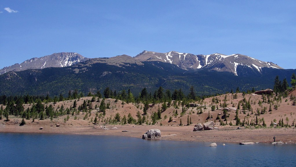
Cruising further down the valley which happens to be full of beaver dams and marsh. You can see the Crags off in the distance.

Close-up of the Crags

Colorful Colorado! Here is our state flower with bugs on it

So after a few hours of riding and the heat starting to get to us we came across this stream to take a break and filter water. Since I have started carrying a filter on my long rides I no longer run out of water and get cramps.

And we are off, this cool section of trail lead us to the Crags Campground area.

So at this point we have passed the Crags Campground and connected with a section of single track that proved to be tough but extremely fun. Lots of elevation to tackle and plenty of twisty technical single-track. We are now on the West side of the peak and the forest is much different that what I am used to on the Front Range side. The west side is more fertile and dense without the large amounts of decomposed red granite that dominates the Front Range.

After about 20 miles of what felt like 40 we came across this valley in hopes of finding a cool camping spot. 20 miles may not seem far but when you are carrying a pack full of camping gear and food it gets tough.

After a short excursion up the valley we came across this picture perfect meadow with a really cool fire ring already built. Nobody is around for miles!

Mikes 4 season tent. I got a new sleeping pad for this trip trading in my painful Thermarest for an inflatable Big Agnes pad that proved for a much more comfortable nights sleep.

I slept like a rock and whipped up some coffee and oatmeal for breakfast. The plan was to ride down the valley further and explore Pancake Rocks then make our way back to where we started.

To get to the top of Pancake Rocks there was a good hour of hike a bike. This is pretty much were the single track ends.Hopefully someday FOTP connect this section with Gold Camp Road. This way you do not have to go down and ride the Highway.

The trail up by Pancake Rocks was fun especially coming back down. We ended up getting bad directions to where the actual pancake rocks were. We never saw them. Not a big deal.

So we turned around at the top and headed back the way we came. There were about 24 tough miles ahead of us. Our packs felt heavy this day.

Sentenial Peak
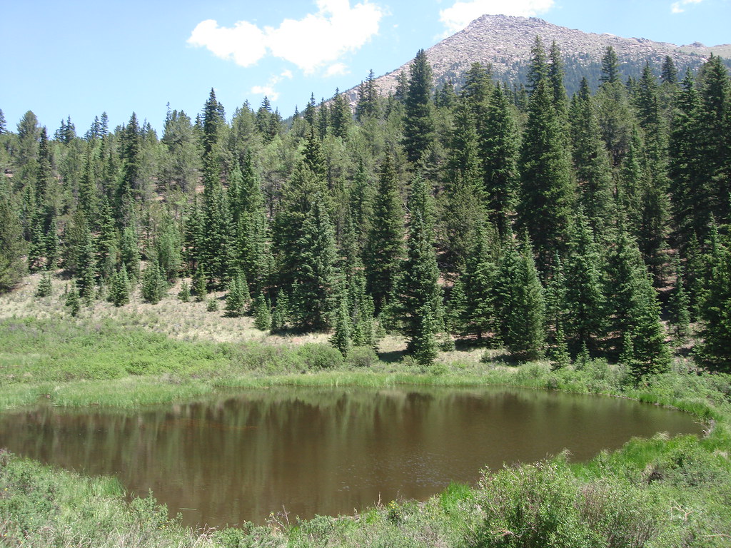
One of the many Beaver Dams along the route.
 ?
?
Shot of the single-track going up Horsetheif Valley. This is a very beautiful area that can be easily accessed at the Horsetheif Falls Trail Head off Highway 67.

What make the Ring the Peak Route so fun is riding all the well built connector trails that link the route. Here is a nice section filled with aspens.

I think if we would have found the Pancake Rocks they would have looked something like this.

I love riding along the Shore of the South Catamount Reservoir. I would describe this section as entry level Rampart Resivoir-ish riding.

Riding along the dam of the North Catamount Reservoir about 2/3 the way back.

Here we are crossing over the outlet of Crystal Reservoir. For some reason the trip back goes by quick.

A dank little section of trail getting us closet to the Mt Ester trail.

Taking a break before the final push back to the car and finish up this grueling but fun 2 day bikepacking trip.
So from here it is mostly down hill all the way back to the car and not to many more photos were taken. All in all we ended up riding about 45 miles over two day with large amounts of elevation. I was beat and it took me a week to recover even being in good shape. I look forward to doing this one in 2009.

Dude, I didn\’t even know you left that day! P.S This is Haven.
LikeLike
dude that is sic
LikeLike